

Geophysical Facility
NCESS has established the Geophysical facility by employing advanced instruments, including the broadband Seismometers, Gravity, Magnetic meters, Ground Penetrating Radar (GPR), Electrical resistivity Meter (ERM), Very-Low frequency (VLF) instrument and Gamma Ray Spectrometer and development & incorporation of advanced methodologies to unravel the concealed internal structure, tectonics and geodynamics of the Earth. The details are provided below.
1. Seismology
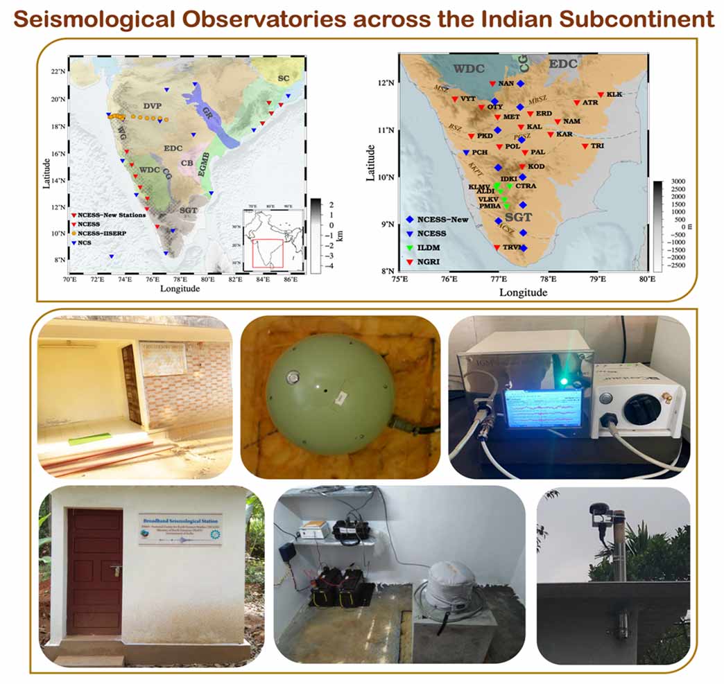
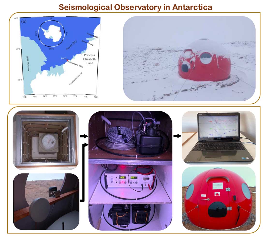
1.1 Broadband Seismological Observatory Network:
NCESS has established a broadband seismological observatory network along the Western Ghats, Eastern Ghats, across major Shear Zones and also established a permanent broadband seismological observatory in the Antarctica region. Earth vibrations generated by earthquakes, volcanoes, and ambient noise are recorded by seismometers, especially the broadband seismometers, to cover the broader spectrum of frequencies, which helps unravel subsurface information from the surface (0 km) to the centre of the Earth (6371 km), enabling the deciphering of the tectonics and geodynamics of a region. In particular, NCESS focuses on understanding the evolution of the Western Ghats, India-Antarctica correlation, and the mapping & characterization of faults and shear zones along with associated natural resource potential, geohazards, seismogenic status, the causes responsible for the Indian Ocean Geoid Low, and the overall tectonics and geodynamics of the Indian subcontinent and the Indian Ocean region.
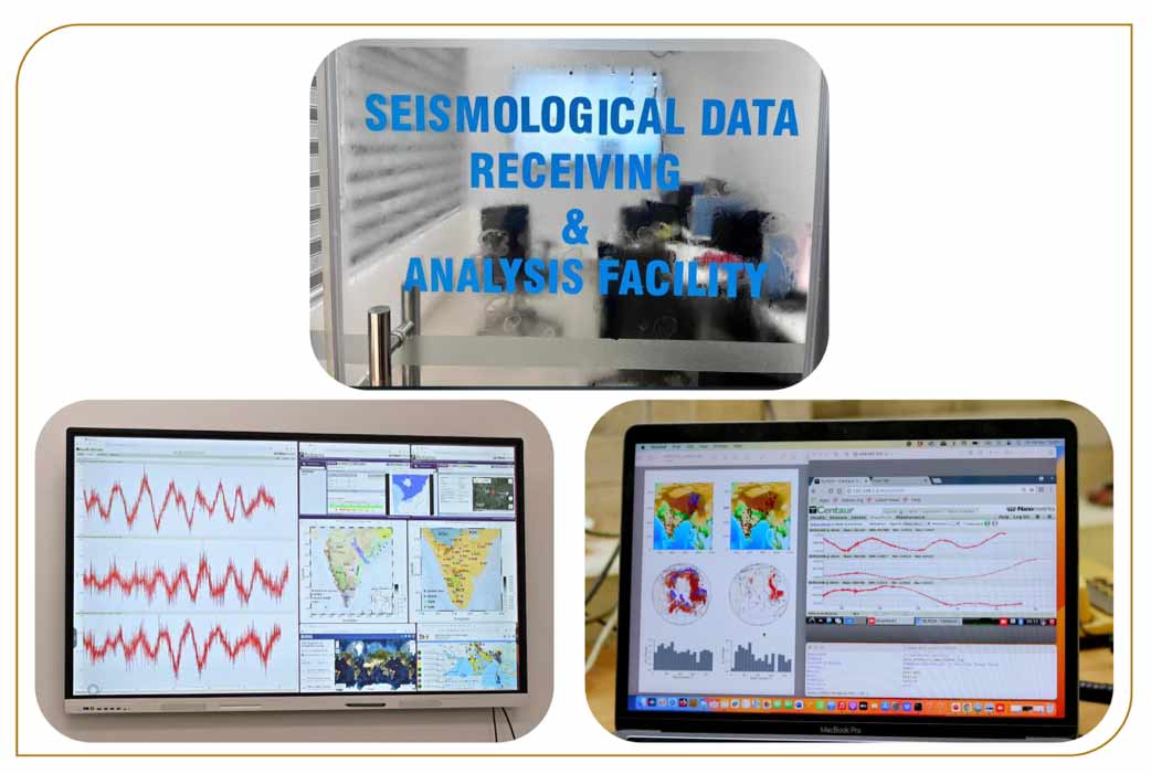
1.2. Seismological Data Receiving & Analysis Facility:
NCESS has established the Seismological Data Receiving & Analysis Facility, which enables the acquisition of real-time data from broadband seismological stations installed across India and Antarctica. This facility supports continuous monitoring and maintenance of these stations, ensuring high-quality data collection. Further, the analysis of real-time seismic data helps in detecting and studying earthquakes, as well as gaining deeper insights into the complex and mysterious processes occurring beneath the Earth’s surface.
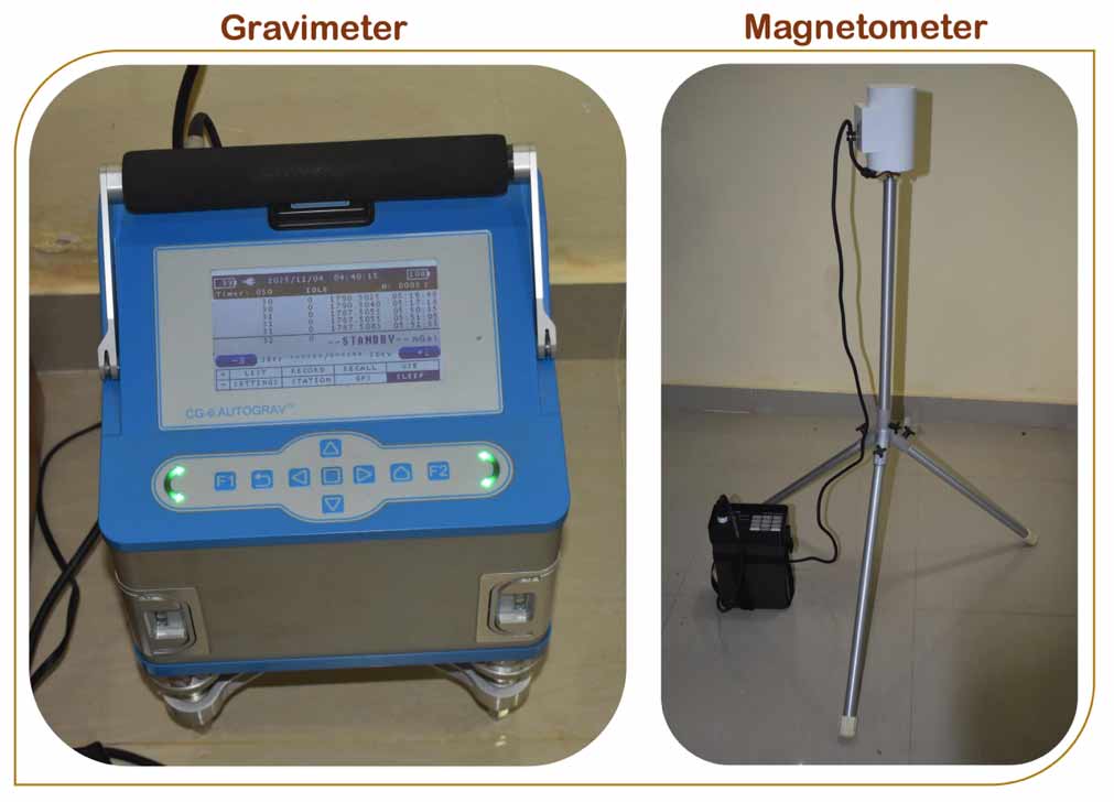
2. Gravity and Magnetic Instruments:
NCESS is equipped with the latest CG-6 relative gravimeter and magnetometers to carry out geophysical potential-field measurements. These instruments measure the Earth’s natural physical fields, such as gravity and magnetism, to investigate the subsurface. A relative gravimeter measures variations in the Earth’s gravitational field arising from changes in rock density. A magnetometer measures spatial variations in magnetic field intensity. These datasets help decipher crustal structure, study isostasy, and understand regional geodynamics.
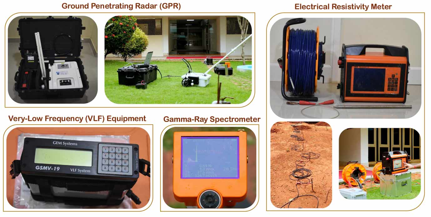
3. Near-surface geophysical instruments:
NCESS is equipped with Ground Penetrating Radar (GPR), Electrical Resistivity Meter (ERM), Very Low Frequency (VLF), and a Gamma-Ray Spectrometer (GRS) to carry out near-surface geophysical measurements. GPR, which transmits electromagnetic pulses into the ground and measures the dielectric permittivity of subsurface materials, enables the mapping of shallow layers, buried objects, and structural features. ERM, which injects electrical current into the ground and measures the resulting potential difference. It is used to map the electrical resistivity distribution of the subsurface, which helps to identify geological layers, groundwater zones, voids, and geological structures. VLF, which uses radio waves in the frequency range of 15-30 kHz to investigate shallow subsurface structures, especially fractures, faults, and conductive anomalies. GRS, which measures natural gamma radiation emitted by soil, rocks, and minerals. It detects gamma rays produced by the radioactive decay of potassium (K), uranium (U), and thorium (Th), which helps to characterize lithology and weathering. The integrated use of these techniques provides a multi-parameter, high-confidence, and cross-validated understanding of the near-surface. These are useful for mapping subsurface layers; identifying faults, fractures, voids, soil piping, bedrock depth, locating utilities, pipes, and buried objects and exploring groundwater, etc.
Contact:
Dr. Padma Rao B
Scientist-In-Charge
T: 0471-2511622
E: geop[dot]lab[at]ncess[dot]gov[dot]in
Dr. Padma Rao B
Scientist-In-Charge
T: 0471-2511622
E: geop[dot]lab[at]ncess[dot]gov[dot]in