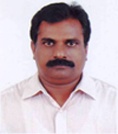
Mr. B.K. Jayaprasad
Scientist E, Hydrological Processes (HyP)
Email : This email address is being protected from spambots. You need JavaScript enabled to view it., This email address is being protected from spambots. You need JavaScript enabled to view it.
Phone(Off) : 0471-2511651
Phone(Res) : 0471-2455322
Fax : 0471-2442280
Education:
| M.Sc. | : | 1991,Geology, Mahatma Gandhi University, Kottayam. |
| B.A | : | 1979, Geography, University of Kerala. |
| Certificate | : | 1997 GIS & Remote Sensing , Indian Institute of Remote Sensing, Anna University Part Time Research Scholar- Department of Geography , University College , Thiruvananthapuram, University of Kerala |
Training Programs attended:
- One week training in “Remote Sensing and GIS” from National Remote Sensing Agency, Balanagar, Hyderabad (26th February to 2nd March 1997)
- Geomedia Professional and Geomedia web enterprise from Rolta India Limited, Mumbai (2nd April 2001 to 4th April 2001)
- Successfully completed a training programme on “ERDAS Imagine” at RSI, Hyderabad from 10th September to 14th September 2007
- Successfully completed the GLONASS- DGPS training organized by Leica GeoSystems, Trivandrum, 2008.
- Successfully completed the training programme conducted by LGGI on Leica Photogrammetry Suit (LPS) at Hyderabad during 13th to 18th October 2008.
- Successfully completed the training programme of “Leica Mobile Matrix Survey” conducted by the Leica Geosystems during November 3-7, 2008 at Thiruvananthapuram.
- Participated the Summer Training workshop on “Research Methodology and Application of SPSS for Data Analysis” conducted on 11th,12th and 13th April-2008- Organized by the Albertan Institute of Management (AIM) Kochi
- Attended International train -the-trainer workshop &Problem analysis workshop on “Integrated Water Resource Management” organized by Eurasia-Pacific Uninet in collaboration with University of Madras during February 22nd to 25th 2010.
Areas of interest:
Cartography, Surveying and Mapping, GIS, Remote Sensing, Cadastral/ Participatory mapping/Tax mapping/ Health mapping, Customization of GIS applications, Management of Software development using open-source/ proprietary software, natural resource mapping, inventory and management, terrain resource evaluation/, land use / land cover change studies and analysis, macro and micro level planning map preparation for decentralized planning, preparation of soil nutrient management plan maps and soil mapping. Building Spatial Urban Information System for urban centers. Agro- ecological mapping and atlas preparation.
Awards/Achievements:
- Nominated as Technical Committee member of Kerala Spatial Data Infrastructure(KSDI), Kerala State IT Mission, Govt. of Kerala
- Review Committee member of “ User Acceptance Test” checklist in connection with Upgraded portal of KSDI, State IT Mission, Govt. of Kerala
- Won the ESRI GIS Technical Quiz Competition during the Second Asia-Pacific User Conference held at New Delhi on January 18th, 2007 and received the award Prof: Jack Dangermond, ESRI President.
- Nominated as Hon: Consultant for UNDP- MOUD Programme for implementation of the project on Capacity Building of Tax mapping of two urban local bodies in Kerala- Palakkad and Alappuzha Municipalities
- Guest faculty of KILA, Thrissur – Handled multi-sessions in GIS and Tax Mapping for Urban Governance (Tax reforms) from July 2007 to August 2009 for the local body officers and elected representatives
- Worked as Cartographer in the Ministry of Development, Muscat, Sultanate of Oman from 1992-1994
Membership of Professional Bodies
- Life member of Indian National Cartographic Association
- Life member of Indian Society of Remote Sensing
Professional career:
| 2013 | - | Present | Scientist-E, National Centre for Earth Science Studies. |
| 2008 | - | 2013 | Scientist-D, Centre for Earth Science Studies. |
| 2004 | - | 2008 | Scientist-C, Information Kerala Mission and CESS |
| 1999 | - | 2004 | Scientist-B, Information Kerala Mission ( On deputation from CESS) |
| 1998 | - | 1999 | Scientific Officer, Cartography C-DIT (On deputation from CESS) |
| 1994 | - | 1998 | Technical Officer, GSD, CESS |
| 1992 | - | 1994 | Cartographer, Ministry of Development, Muscat, Sultanate of Oman |
| 1989 | - | 1992 | Junior Technical Assistant, RAD, CESS |
| 1987 | - | 1989 | Took study leave to pursue MSc. Course in Cartography at Madras University |
| 1982 | - | 1987 | Technician Group2, Grade2 , RAD, CESS |
| 1980 | - | 1982 | Junior Technician, RAD, CESS |
| 1979 | - | 1980 | Compiler, RAD, CESS |


 सूचना का अधिकार
