Marine Science Group (MSG)
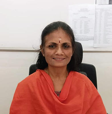
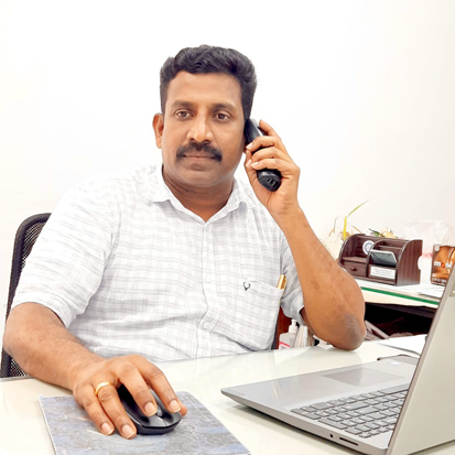
Dr. S. Kaliraj
Scientist D
Marine Science Group (MSG)
Email : s[dot]kaliraj[at]ncess[dot]gov[dot]in
Phone(Off): 0471-2511653
Mobile : 6238294220
Fax : 0471-2442280
Education
Ph. D. : 2016, Remote Sensing - GeoTechnology, Manonmaniam Sundaranar University, Tirunelveli.
M.Tech. : 2011, Geomatics, Indian Institute of Surveying & Mapping (IIS&M), Survey of India, affiliated to JNTU, Hyderabad.
M.Sc. : 2008, Remote Sensing & GIT, Madurai Kamaraj University, Madurai.
GATE : 2024, Qualified for GATE - Geomatics Engineering (GE).
Professional career
- 2023 - Present Scientist D, National Centre for Earth Science Studies.
- 2019 - 2023 Scientist C, National Centre for Earth Science Studies.
- 2016 - 2019 Scientist B, National Centre for Earth Science Studies.
- 2013 - 2016 DST-INSPIRE - SRF, M.S. University, Tirunelveli.
- 2011 - 2013 DST-INSPIRE - JRF, M.S. University, Tirunelveli.
Area of Specialization & Interest
Honors/Awards/Fellowships/Recognitions
- MoES - Certificate of Merit Award (Geoscience) 2021, MoES, Govt. of India, New Delhi.
- Young Scientist of the Year 2016 Award conferred by IFEE, Kolkata, and CIU, New Delhi.
- Green Technologist of the Year Award 2017 conferred by SERI, Kolkata.
- CUSAT - Ph.D. Guideship - Faculty of Marine Science & Faculty of Environ. Studies.
- NCESS Course Coordinator for IIRS - ISRO Edusat Outreach Programme.
- Resource Person for UGC/ DST/ FDP/ AICTE sponsored training courses.
Membership in Professional Bodies
- Life member - Indian Society of Remote Sensing (ISRS).
- Life member - Ocean Society of India (OSI).
- Life member - Indian Society of Geomatics (ISG).
- Member - International Society for Photogrammetry and Remote Sensing (ISPRS).
View Google Scholar Link
ORCID
Vidwanid
Other Professional Activities (Professional Training/Committees/Editorial Services)
- Member - NCESS - CRZ Monitoring Committee.
- Member - NCESS - Map Library Physical Verification Committee.
- Member - NCESS - Technical Committee for AMC.
- Course Coordinator - NCESS - IIRS Edusat outreach program.
Training Courses
- IIRS-ISRO sponsored training course "Landslide mitigation strategies using remote sensing data and open-source GIS tools," organized by the Dept. of Geology, University of Kerala, Trivandrum on July 31 - August 05, 2023.
- ICAR sponsored a training course on Airborne Hyperspectral Remote Sensing for Agriculture, which was organized by NAHEP, New Delhi, on 16 - 25 January 2023.
- DST sponsored Winter School Training course "Recent Advances in Marine Geospatial Technologies," IIT Madras, Jan 03 - 23, 2022.
- NGP-DST sponsored training course on "Geo-Innovation Challenge on Meteorology and Ocean Science" organized by Sathyabama Institute of Science & Technology, Chennai, on 20 - 22 April 2022.
- AICTE - STTP training course "Remote sensing, GIS & GNSS (Phase II)," FX Engineering College, Tirunelveli, September 21 - 26, 2020.
- Training Course on "Remote sensing of Land Degradation," IIRS, Dehradun, 01.12.2020 - 07.12.2020.
- Training Course on "Synthetic Aperture Radar (SAR) Data Processing and Analysis," IIST-ISRO, Thiruvananthapuram, October 16 - 18, 2019.
- Training Course on "Principles of Polarimetric SAR Remote Sensing and its Processing," IIRS, Dehradun, 18.02.2019 - 01.03.2019.
- Training course on "Advanced remote sensing technologies: Hyperspectral Remote sensing and LiDAR (GEOCONNECT - 2018)", IIST - ISRO, Thiruvananthapuram, June 11 - 14, 2018.
- Training Course on "Application of SARPROZ SW for Multi-Temporal InSAR processing techniques," CGL-NCESS, February 2018.
- Training Course on "Desertification and Land Degradation Monitoring, Vulnerability Assessment, and Combating Plans," SAC-ISRO, Ahmedabad, March 14 - 22, 2018.
- Basic course on "Image Processing with MATLAB software," MathWorks, Bangalore, April 2017.
- Training Course on "Exploring ENVI," ESRI India, May 2017.
- Training Course on "Applications of Remote Sensing and GIS for Natural Resources" IIRS-ISRO, Dehradun, January - March 2015.
- Training Course on "Satellite Remote Sensing for Earth Science Research (DST-NRDMS Sponsored)", Centre for Earth & Space Sciences, University of Hyderabad, Hyderabad, September - October 2014.
- International Training Course on "Ocean Colour Remote Sensing - Data, Processing & Applications (ITCOocean & IODE Sponsored)" Indian National Centre for Ocean Information Services (INCOIS), Hyderabad, November 10 - 14, 2014.
- Certificate course on "Microwave (SAR) Remote Sensing for Natural Resources" IIRS-ISRO, Dehradun, February - March 2014.
- Certificate course on "Remote sensing, GIS and GNSS" IIRS-ISRO, Dehradun, August - November 2014.
- Training Course on "Geospatial Technologies & Applications (NRDMS Sponsored)," JNTU, Hyderabad, June - July 2012.
- Training Course on "Photogrammetry Applications (6 weeks Training course - ISRO Sponsored)", Institute of Remote Sensing (IRS), Anna University, Chennai, May - June 2009.
- Training Course on "Geoinformatics in disaster management (NNRMS - ISRO Sponsored)," Geological Survey of India Training Institute (GSITI), Hyderabad, April - May 2009.
- Training Course on "Coastal System: Remote sensing and GIS application (INCOIS Sponsored)," Centre for Studies on the Bay of Bengal, Andhra University, Vishakhapatnam, February 02-14, 2009.
- Certificate course on "Basics of Remote sensing, GIS and GPS" IIRS-ISRO, Dehradun, January - May 2007.
Projects (Inhouse) Completed as PI
- Spatio-temporal variability of LST & UHI in Kozhikode - rapid urbanized region using Landsat Time Series Data Analysis - Year of Completion - 2024.
- Assessment of Soil Erosion and Sediment Yield Estimation in the tropical river basin, Western Ghats, using GIS-based RUSLE model - Year of Completion - 2024.
- Future Prediction of Flood-Susceptible Zones in the Thamirabarani Basin, South India - Year of Completion - 2023.
- Assessment of rainfall-runoff and its impacts on landforms in river Thamirabarani sub-basin, Southern India - Year of Completion - 2023.
- Assessment of Hydrochemical characteristics and water quality in the Vellayani Lake - a freshwater source of Thiruvananthapuram City, Kerala - Year of Completion - 2022.
- Landslide Hazard Zonation in the Chaliyar River Basin of the Western Ghats using GIS - Machine Learning Technique - Year of Completion - 2021.
- Spatio-temporal predictability of suspended sediments, salinity in the Ashtamudi Lake - Ramsar Site using remote sensing data - Year of Completion - 2020.
- Assessment of Land degradation Vulnerability in humid tropics (Kerala) and Semi-Arid (Tamil Nadu) regions, Southern India - Year of Completion - 2020.
- Morphometry Analysis of Hemavati River Basin using Remote Sensing and GIS techniques - Year of Completion - 2019.
- Mapping of Slope Failure Hazard Zonation in the Chaliyar River Basin Using GIS-Based Slope Stability Index Model - Year of Completion - 2019.
- Identification of seawater intrusion vulnerable zones and hydrochemical indicators in the Southern India coastal aquifers using the GALDIT model - Year of Completion - 2019.
- Identification of suitable sites for rainwater harvesting structures in tropical and sei-arid watersheds using Remote sensing GIS techniques - Year of Completion - 2018.
- Development of Coastal Habitat Vulnerability Index (HVI), Environmental Vulnerability Index (EVI), and modified coastal vulnerability to sea level rise (modified CVI) models - Year of Completion - 2018.
- Identification of suitable recharge sites for groundwater augmentation in Mannarkad Watershed, Palakkad, Kerala - Year of Completion - 2017.
- Coastal Landuse and Land cover change detection and transformation assessment using Landsat time series data - Year of Completion - 2017.
- Coastal Geomorphological Mapping and Volumetric Change Assessment along the SW coast of India - Year of Completion - 2016.
Projects (External Funded) Completed as PI
- Desertification & Land Degradation: Monitoring, Vulnerability Assessment and Combating Plans for Kerala and Tamil Nadu (2018-2021) - Year of Completion - 2021 - Funding Agency - SAC - ISRO.
PhDs Guided
- Shaginimol C.N. - Identification of suitable sites for shrimp farming in brackish water areas of Ernakulam district, Kerala, using Geographic Information System (GIS) techniques, KUFOS, Kochi - 2024 (Co-guide).
- Fathimathu Sahala P S - Assessment of Coastal Landforms Dynamics and Habitat Vulnerability using Remote Sensing and GIS Techniques - A Case Study of Southern India -2024 (ongoing).
Publications
- Kaliraj, S., Shunmugapriya, S., Lakshumanan, C. Suresh, D. et al. (2024) Flood risk zone mapping and future projections for the Thamirabarani river basin, Southern India: insights from decadal rainfall trends and GIS-based analytical hierarchy process technique. Natural Hazards (Springer). https://doi.org/10.1007/s11069-024-07007-z.
- Kaliraj, S., Chandrasekar, N., Ramachandran, K.K., Lalitha M. (2023) GIS-based NRCS-CN modeling of rainfall-runoff in river Thamirabarani sub-basin, Southern India. Journal of Hydro-environment Research, 49, 10-27. https://doi.org/10.1016/j.jher.2023.07.001.
- Krishnakumar, Aditya, Anoop Krishnan, V. Nandakumar, Kaliraj, S.,Jeenu Jose (2022) Establishment of Baseline Reference Geochemical Values in Tropical Soils of Western Ghats: Assessment of Periyar Basin with Special Reference to Contaminant Geochemistry. CLEAN-Soil, Air, Water, (Wiley Publications), https://doi.org/10.1002/clen.202200382.
- ShaginimolC.N., Manojkumar, B.,Kaliraj, S. (2022) Spatial distribution of heavy metals in surface water from coastal areas of Ernakulam district, Kerala, South-west coast of India. Ecol.Environ.& Cons. 28, S151-S159, http://doi.org/10.53550/EEC.2022.v28i07s.026.
- A. Krishnakumar, J. Jose, Kaliraj, S., S.K. Aditya, K. Anoop Krishnan (2022) Assessment of the impact of the flood on groundwater hydrochemistry and its suitability for drinking and irrigation in the River Periyar Lower Basin, India. Environ Sci Pollut Res. https://doi.org/10.1007/s11356-021-17596-y.
- S.S. Salaj, D. Ramesh, D.S. Suresh Babu, Kaliraj, S., Chandrasekar N. (2022) Appraisal of urban growth impacts on seawater intrusion vulnerability using GIS-based modified GALDIT-U model: a case study of Kozhikode coastal stretch, Kerala, South India. Journal of Applied Remote Sensing, 16(1), 012014. https://doi.org/10.1117/1.JRS.16.012014.
- S. Selvakumar, N. Chandrasekar, Y. Srinivas, S. Selvam, Kaliraj, S., Magesh, N.S., Venkatramanan S. (2022) Hydrogeochemical processes controlling the groundwater salinity in the coastal aquifers of Southern Tamil Nadu, India. Marine Pollution Bulletin, 174, 113264. https://doi.org/10.1016/j.marpolbul.2021.113264.
- Rejith, R.G. Sundararajan, M., Gnanappazham, L., Kaliraj, S., Ramaswamy S.I. (2022) GIS-based machine learning algorithms for mapping beach placer deposits in the south-west coast of India using Landsat-8 OLI images. Journal of Applied Remote Sensing, 16(1), 012011. https://doi.org/10.1117/1.JRS.16.012011.
- Rejith, R.G. Sundararajan, M. Gnanappazham, L., Kaliraj, S., Chandrasekar N. (2022) Exploring beach placer minerals in the east coast of Tamil Nadu, India using EO-1 Hyperion data. Journal of Applied Remote Sensing, Vol. 16(1), https://doi.org/10.1117/1.JRS.16.012017.
- S. Arunbose, Y. Srinivas, S. Rajkumar, Nithya C. N., Kaliraj, S. (2021) Remote sensing, GIS and AHP techniques-based investigation of groundwater potential zones in the Karumeniyar river basin, Tamil Nadu, southern India. Groundwater for Sustainable Development, 14, 100586. https://doi.org/10.1016/j.gsd.2021.100586.
- Lalitha, M. Dharumarajan, S., Kalaiselvi, B., Shivanand, K., Koyal, A., Kaliraj S, Hegde, R. (2021) Hydrochemical characterization and groundwater quality in Cauvery deltaic fluvial plains of Southern India. Environ Sci Pollut Res, 28, 44861-44876. https://doi.org/10.1007/s11356-021-13467-8.
- Lalitha, M.,Kumar, K.S.A.,Nair, K.M.,Dharumarajan, S.,Koyal, A.,ShivanandK., Kaliraj S, R. Hegde (2021) Evaluating pedogenesis and soil Atterberg limits for inducing landslides in the Western Ghats, Idukki District of Kerala, South India. Nat Hazards 106, 487-507. https://doi.org/10.1007/s11069-020-04472-0.
- B.R. Tripathy, X. Liu, M. Songer, L. Kumar, Kaliraj S, N.D. Chatterjee, W.M.S. Wickramasinghe, K.K. Mahanta (2021) Descriptive Spatial Analysis of Human-Elephant Conflict (HEC) Distribution and Mapping HEC Hotspots in Keonjhar Forest Division, India. Front. Ecol. Evol. 9:640624. doi: 10.3389/fevo.2021.640624.
- Antony, S., Dev, V.V., Kaliraj, S., Ambili, M.S., Krishnan, K. A. (2020). Seasonal variability of groundwater quality in coastal aquifers of Kavaratti Island, Lakshadweep Archipelago, India. Groundwater for Sustainable Development (Elsevier), 11, 100377. doi:10.1016/j.gsd.2020.100377.
- Antony, S., Dev, V. V., Mahadevan, H., Kaliraj, S., Ajayan, A., & Krishnan, K. A. (2020). Environmental influences on zooplankton diversity in the Kavaratti lagoon and offshore, Lakshadweep Archipelago, India. Regional Studies in Marine Science (Elsevier), 101330. doi:10.1016/j.rsma.2020.101330.
- Nair, N.C., Srinivas, Y., Magesh, N.S., Kaliraj, S. (2019). Assessment of groundwater potential zones in Chittar basin, Southern India, using GIS-based AHP technique. Remote Sensing Applications: Society and Environment (Elsevier) doi:10.1016/j.rsase.2019.100248.
- Kaliraj, S. Chandrasekar, N., Ramachandran, K.K., Selvakumar S. (2019) Seawater intrusion vulnerability in the coastal aquifers of southern India-an appraisal of the GALDIT model, parameters' sensitivity, and hydrochemical indicators. Environmental Science and Pollution Research (Springer) https://doi.org/10.1007/s11356-019-04401-0.
- Kaliraj S., Chandrasekar N., Ramachandran K.K. (2019) Coastal habitat vulnerability of Southern India: a multiple parametric approaches of GIS-based HVI (Habitat Vulnerability Index) model. Physical Geography and Quaternary Dynamics (GFDQ), 42, doi: 10.4461/GFDQ.2019.42.3.
- Tripathy, B.R., Kaliraj, S.,Sajjad, H., Joshi, P.K., Chaudhary, B.S., Kumar, P. (2018) Monitoring of seasonal variability and movement of suspended sediment concentrations along the Thiruvananthapuram coast, southern India, using the Landsat OLI sensor. Ocean Science (European Geosciences Union), 14, 1085-1092, https://doi.org/10.5194/os-14-1085-2018.
- Selvakumar, S., Chandrasekar, N., Kaliraj, S.,Magesh, N.S. (2018) Salinization of shallow aquifer in the Karamaniyar river basin, Southern India. Environment, Development and Sustainability (Springer), 1255-1273. https://doi.org/10.1007/s10668-017-9937-5.
- Rejith, R.G., Sundararajan, M., Kaliraj,S. (2018) A Geo-processing Modeling of Deltaic Suspended Sediment Variability. Journal of Geovisualization and Spatial Analysis (Springer), 2(13), https://doi.org/10.1007/s41651-018-0020-z.
- Salaj, S.S., Ramesh, D., Babu, D.S., Kaliraj,S. (2018) Impacts of urbanization on groundwater vulnerability along the Kozhikode coastal stretch, Southwestern India using GIS-based modified DRASTIC-U Model. Journal of Coastal Sciences, 5(2), 1-27.
- Kaliraj, S.,Chandrasekar, N., Ramachandran, K.K., Srinivas, Y., Saravanan, S. (2017) Coastal landuse and land cover change and transformations of Kanyakumari coast, India using remote sensing and GIS. The Egyptian Journal of Remote Sensing and Space Sciences (Elsevier publication & SCI Journal). DOI: 10.1016/j.ejrs.2017.04.003.
- Kaliraj, S.,Chandrasekar, N., Ramachandran, K.K. (2016) Mapping of coastal landforms and volumetric change analysis in the South-west coast of Kanyakumari, South India using remote sensing and GIS techniques. The Egyptian Journal of Remote Sensing and Space Science (Elsevier publication & SCI Journal). DOI: 10.1016/j.ejrs.2016.12.006.
- Bheeroo, R.A., Chandrasekar, N., Kaliraj, S.,Magesh, N.S. (2016) Shoreline change rate and erosion risk assessment along the Trou Aux Biches-Mont Choisy beach on the northwest coast of Mauritius using GIS-DSAS technique. Environ. Earth Sciences (Springer Group & SCI journal). DOI 10.1007/s12665-016-5311-4.
- Kaliraj, S.,Chandrasekar, N., Magesh, N.S. (2015) Evaluation of multiple environmental factors for site-specific groundwater recharge structures in the Vaigai River upper basin, Tamil Nadu, India using GIS-based Weighted Overlay Analysis. Environmental Earth Sciences (Springer Group & SCI journal). DOI: 10.1007/s12665-015-4384-9.
- Kaliraj, S.,Chandrasekar, N., Magesh, N.S. (2014) Morphometry analysis of the River Thamirabarani sub-basin in Kanyakumari District, South-west coast of Tamil Nadu, India, using remote sensing and GIS. Environmental Earth Sciences (Springer Group & SCI journal) Vol. 73(11), DOI: 10.1007/s12665-014-3914-1.
- Kaliraj, S., Chandrasekar, N., Simon Peter, T., Selvakumar, S., Magesh, N.S. (2014) Mapping of coastal aquifer vulnerable zone in the South-west coast of Kanyakumari, South India, using GIS-based DRASTIC model. Environmental Monitoring and Assessment (Springer Group & SCI journal) ISSN: 1573-2959. DOI 10.1007/s10661-014-4073-2.
- S. Selvakumar, K. Ramkumar, N. Chandrasekar, N. S. Magesh, S. Kaliraj (2014) Groundwater quality and its suitability for drinking and irrigational use in the Southern Tiruchirappalli district, Tamil Nadu, India. Applied Water Science. DOI 10.1007/s13201-014-0256-9.
- Kaliraj, S.,Chandrasekar, N., Magesh, N.S. (2014) Multispectral image analysis of suspended sediment concentration along the Southern coast of Kanyakumari, Tamil Nadu, India. Journal of Coastal Sciences. ISSN 2348 - 6740. Vol. 1(1). Page: 63-71.
- Kaliraj, S.,Chandrasekar, N., Magesh, N.S. (2013) Evaluation of coastal erosion and accretion process along the South-West coast of Kanyakumari, Tamil Nadu using Geospatial techniques. Arabian Journal of Geosciences (Springer Group & SCI journal). ISSN: 1866-7538. DOI: 10.1007/s12517-013-1216-7.
- Kaliraj, S.,Chandrasekar, N., Magesh, N.S. (2013) Impacts of Wave energy and Littoral currents on Shoreline erosion /accretion along the South-West Coast of Kanyakumari, Tamil Nadu using DSAS and Geospatial Technology. Environmental Earth Sciences. DOI: 10.1007/s12665-013-2845-6.
- Magesh, N.S., Chandrasekar, N., Kaliraj,S. (2013) Mapping of heavy mineral placers through marine GIS expert system: a case study in Kalaignanapuram coastal stretch, southeast coast of Tamil Nadu, India. Arabian Journal of Geosciences.DOI: 10.1007/s12517-013-1193-x.
- Kaliraj, S.,Chandrasekar, N., Magesh, N.S. (2012) Identification of potential groundwater recharge zones in R. Vaigai upper basin, TN using GIS-based Analytical Hierarchical Process (AHP) technique. Arabian Journal of Geosciences. DOI:10.1007/s12517-013-0849-x.
- Kaliraj, S.,Muthu Meenakshi, S., et al., (2012) Application of Remote sensing in Forest cover change detection using Geo statistical change detection matrices - A case study in Devampatti RF, Tamil Nadu. Nature Environment & Pollution Technology (International Quarterly Scientific Journal). ISSN: 0972 - 6268.11(2), 261-269.
Book/ Monographs /Chapters/Edited Volumes
- S. Dharumarajan, S. Kaliraj, K. Adhikari, M. Lalitha, N. Kumar (2023) Remote Sensing of Soils: Mapping, Monitoring and Measurement (1st Edition) in Earth Observation Series (Elsevier Publications USA), ISBN: 978-0-44-318773-5, https://doi.org/10.1016/C2022-0-00254-3.
- Meenu Rani, S. Kaliraj, Sufia R, Pavan Kumar, Haroon S (2020) Remote Sensing of Ocean and Coastal Environments (1st Edition) in Earth Observation Series (Elsevier Publications USA), ISBN: 978-0-12-819604-5, https://doi.org/10.1016/C2019-0-00225-7.
Chapters in Books / Proceedings
- S. Kaliraj et al., (2023) Remote sensing and geographic information system applications in mapping and assessment of soil resources. In Dharumarajan et al., (Edrs) Remote Sensing of Soils: Mapping, Monitoring, and Measurement., Elsevier, USA, ISBN: 978-0-44-318773-5, https://doi.org/10.1016/B978-0-443-18773-5.00014-4.
- S. Kaliraj et al., (2023) Remote sensing indices-based soil properties measurement - a case study of the Thamirabarani River Basin, South India. In Dharumarajan et al., (Edrs) Remote Sensing of Soils: Mapping, Monitoring, and Measurement., Elsevier, USA, ISBN: 978-0-44-318773-5, https://doi.org/10.1016/B978-0-443-18773-5.00030-2.
- S. Kaliraj et al., (2023) Assessment of land degradation vulnerability in the semi-arid region of Southern India using GIS-based MEDALUS approach. In Dharumarajan et al., (Edrs) Remote Sensing of Soils: Mapping, Monitoring, and Measurement., Elsevier, USA, ISBN: 978-0-44-318773-5, https://doi.org/10.1016/B978-0-443-18773-5.00038-7.
- S. Kaliraj et al., (2023) Mapping of slope failure hazard zonation subject to soil characteristics: a case study of the Chaliyar River Basin, the Western Ghats, South India. In Dharumarajan et al., (Edrs) Remote Sensing of Soils: Mapping, Monitoring, and Measurement., Elsevier, USA, ISBN: 978-0-44-318773-5, https://doi.org/10.1016/B978-0-443-18773-5.00043-0.
- S. Kaliraj, Parvathi, M.S. (2023) GIS-Based Slope Stability Index Modelling of Slope Failure Hazard Zonation in the Chaliyar River Basin of the Western Ghats, Kerala, South India. - Proceedings of the CTESS, University of Kerala Publishing, Dhanil Dev, S.G., Shaji, E., Pradeepkumar, A. P. (Eds). ISBN: 978-81-961543-0-1, Chapter 24, pp.51-55.
- K. Chandramohan, G. Vijayalakshmi, S. Kaliraj(2023). Evaluating the relation of NDVI, NDWI, SMI, and LAI with land and soil degradation zones - a case study of Virudhunagar district, Tamil Nadu, India. In Dharumarajan et al., (Edrs) Remote Sensing of Soils: Mapping, Monitoring, and Measurement., Elsevier, USA, ISBN: 978-0-44-318773-5, https://doi.org/10.1016/B978-0-443-18773-5.00040-5.
- S. Kaliraj, Parmar, M., Bahuguna, I.M., Rajawat, A.S. (2022). Assessment of Desertification and Land Degradation Vulnerability in Humid Tropics and Sub-tropical Regions of India Using Remote Sensing and GIS Techniques. In: Sajjad, et al., (eds) Challenges of Disasters in Asia (Springer), https://doi.org/10.1007/978-981-19-3567-1_2.
- S. Kaliraj, K.K. Ramachandran, N. Chandrasekar (2020) Modeling of coastal environmental vulnerability in South India: a multiple parametric approach using remote sensing and GIS. Remote sensing of Ocean and Coastal Environment (Elsevier Publications), Editor(s): Meenu Rani, Kaliraj Seenipandi, Sufia Rehman, Pavan Kumar, Haroon Sajjad, Pages 225-249, ISBN 9780128196045, https://doi.org/10.1016/B978-0-12-819604-5.00014-7.
- S. Kaliraj, K.K. Ramachandran, N. Chandrasekar (2020) Modeling of coastal vulnerability to sea-level rise and shoreline erosion using modified CVI model. Remote sensing of Ocean and Coastal Environment (Elsevier Publications), Editor(s): Meenu Rani, Kaliraj Seenipandi, Sufia Rehman, Pavan Kumar, Haroon Sajjad, Pages 315-340, ISBN 9780128196045, https://doi.org/10.1016/B978-0-12-819604-5.00018-4.
- S. Kaliraj, K.K. Ramachandran, Prashant Ghadei, Sulochana Shekhar (2020) Seasonal variability of sea surface temperature in Southern Indian coastal water using Landsat 8 OLI/TIRS images. Remote sensing of Ocean and Coastal Environment (Elsevier Publications), Editor(s): Meenu Rani, Kaliraj Seenipandi, Sufia Rehman, Pavan Kumar, Haroon Sajjad, Pages 277-295, ISBN 9780128196045, https://doi.org/10.1016/B978-0-12-819604-5.00016-0.
- S. Kaliraj, K.K. Ramachandran, Prashant Ghadei, Sulochana Shekhar (2020) Ocean remote sensing for seasonal predictability of Phytoplankton (chl-a) Biomass in the Southern Indian coastal water region using Landsat 8 OLI images. Remote sensing of Ocean and Coastal Environment (Elsevier Publications), Editor(s): Meenu Rani, Kaliraj Seenipandi, Sufia Rehman, Pavan Kumar, Haroon Sajjad, Pages 31-46, ISBN 9780128196045, https://doi.org/10.1016/B978-0-12-819604-5.00003-2.
- S. Kaliraj, K.K. Ramachandran, Pavan Kumar (2020) Ocean remote sensing for spatio-temporal variability of wave energy density and littoral current velocity in the Southern Indian offshore. Remote sensing of Ocean and Coastal Environment (Elsevier Publications), Editor(s): Meenu Rani, Kaliraj Seenipandi, Sufia Rehman, Pavan Kumar, Haroon Sajjad, Pages 47-63, ISBN 9780128196045, https://doi.org/10.1016/B978-0-12-819604-5.00004-4.
- S. Kaliraj, K.K. Ramachandran, Prashant Ghadei, Sulochana Shekhar (2020) Ocean remote sensing of seawater salinity and its seasonal variability: a case study of Southern Indian coastal water using Landsat 8 OLI images. Editor(s): Remote sensing of Ocean and Coastal Environment (Elsevier Publications), Editor(s): Meenu Rani, Kaliraj Seenipandi, Sufia Rehman, Pavan Kumar, Haroon Sajjad, Pages 65-81, ISBN 9780128196045, https://doi.org/10.1016/B978-0-12-819604-5.00005-6.
- S. Kaliraj, K.K. Ramachandran, Prashant Ghadei, Sulochana Shekhar (2020) Ocean remote sensing of suspended sediment variability in Southern Indian coastal water region using Landsat 8 OLI images. Remote sensing of Ocean and Coastal Environment (Elsevier Publications), Editor(s): Meenu Rani, Kaliraj Seenipandi, Sufia Rehman, Pavan Kumar, Haroon Sajjad, Pages 297-313, ISBN 9780128196045, https://doi.org/10.1016/B978-0-12-819604-5.00017-2.
- Krishnakumar A., S.K. Aditya, S. Kaliraj, K. Anoop Krishnan, Jeenu Jose (2020) Evaluation of suspended sediment concentration and heavy metal distribution in Ashtamudi Lake, a Ramsar site in the south-west coast of India using remote sensing and GIS techniques. Remote sensing of Ocean and Coastal Environment (Elsevier Publications), Editor(s): Meenu Rani, Kaliraj Seenipandi, Sufia Rehman, Pavan Kumar, Haroon Sajjad, Pages 251-275, ISBN 9780128196045, https://doi.org/10.1016/B978-0-12-819604-5.00015-9.
- S. Kaliraj., Chandrasekar N., Ramachandran K.K. (2019) Phytoplankton (chl-a) Biomass Seasonal Variability in the Gulf of Mannar, South India: A Remote Sensing Perspective. In: Kumar et al., (eds) Applications and Challenges of Geospatial Technology (Springer), https://doi.org/10.1007/978-3-319-99882-4_5.
- Salaj S.S., Srivastava S.K., Dugal R., Upadhyay R., Suresh Babu D.S., S. Kaliraj (2019) Application of ASTER Remote Sensing for Lithological Mapping in the Udaipur District of Rajasthan, India. In: Kumar et al., (eds) Applications and Challenges of Geospatial Technology (Springer), https://doi.org/10.1007/978-3-319-99882-4_7.
- Rani M., S. Kaliraj, Ahmed R., Tripathy B., Tripathy B.R., Pippal G.S. (2019) A Sediment Dynamic Modelling of Landsat OLI Image for Suspended Sediment Drift Along the South-west Coast of India. In: Kumar et al., (eds) Applications and Challenges of Geospatial Technology (Springer), https://doi.org/10.1007/978-3-319-99882-4_9.
- N. Chandrasekar, S. Kaliraj (2013) Coastal Erosion and Accretion Assessment and Inundation Risk zone mapping along SW coast of Kanyakumari, Tamil Nadu, India. In Int. Conference on Geological Engineering hosted by University of Malaya, Kuala Lumpur, Malaysia on January 2013, AUN-SEED Group, Malaysia. ISBN: 978-967-0380-23-0.
- S. Kaliraj, K. Mahendran, N. Chandrasekar (2012) "Maximum Likelihood Classifier and Digital Image Processing Techniques for extraction of Coastal Landform features from the Indian Remote Sensing Satellite (IRS P6) LISS III imagery". National Conference on Signal and Image Processing hosted by Dept of Computer Science and Applications, Gandhigram Rural Institute, Gandhigram on Feb.04-05, Excel India Publishers, New Delhi, ISBN: 978-93-81361-90-0.
Conferences/Seminars/Symposia
- Kaliraj, S., Fathimathu Sahala, P.S. have presented a research paper entitled "Development of Habitat Vulnerability Index (HVI) for Southern Indian Coastal Stretch: A Machine Learning-based Spatial Modelling Approach" in the ICTR3 2024 - International Conference, organized by Amrita Vishwa Vidyapeetham, Kerala on 13-15 December 2024.
- S. Kaliraj has presented a research paper entitled "Remote sensing indices-based measurement of soil properties using Landsat 9 - OLI data" in the GeoVista 2023 - National Seminar, organized by the Dept. of Geography, Central University of Tamil Nadu, Thiruvarur, on 06 - 07 July 2023.
- S. Kaliraj has presented a research paper entitled "GIS-based RUSLE modeling of soil erosion assessment in the River Thamirabarani Basin, South India" in the 3rd National Seminar on Spatial Data Modelling: Emerging Trends and Utilities, organized by IUCGIST, Kerala University Campus, Thiruvananthapuram., on 24 - 25 March 2023.
- S. Kaliraj has presented a research paper entitled "GIS - Machine Learning Technique of Landslide Hazard Zonation in the Chaliyar River Basin of the Western Ghats, India"at the Frontiers in Geosciences Research Conference (FGRC-2023), organized by Physical Research Laboratory (PRL), Ahmedabad, on 1 - 3 February 2023.
- S. Kaliraj has presented a research paper entitled "GIS-Based Slope Stability Index Modelling of Slope Failure Hazard Zonation in the Chaliyar River Basin of the Western Ghats, Kerala, South India" in the National Seminar on Current Trends in Earth System Sciences seminar (CTESS 2022-23), organized by Kerala University, Thiruvananthapuram, Kerala, on 19 - 21 January 2023.
- S. Kaliraj has presented a research paper entitled "GIS modeling of Groundwater augmentation through runoff harvesting in the hilly watershed of the Western Ghats, South India"at the ICIWRM-2022, organized by Karunya Institute of Technology and Sciences, Coimbatore, on 8 - 10 December 2022.
- S. Kaliraj has presented a research paper entitled "Hydrochemical characterization and water quality assessment in the Vellayani Lake - a freshwater source of Thiruvananthapuram City, Kerala, Southern India" in the ICRAWST- 2022, organized by Sri Shakthi Institute of Engineering and Technology, Tamil Nadu, on 6 - 8 December 2022.
- S. Kaliraj has presented a research paper entitled "Desertification Vulnerability Assessment in humid tropics and sub-tropical regions of India using Remote Sensing& GIS Techniques" International Conference on "Challenges of Disaster: Vulnerability, Adaptation and Resilience", Jamia Millia Islamia, New Delhi, March 02-03, 2021.
- S. Kaliraj presented a project work report on "Desertification and Land Degradation: Monitoring, Vulnerability Assessment and Combating Plans for Tamil Nadu and Kerala" at SAC-ISRO, Ahmedabad, on 16 - 18 January 2020.
- S. Kaliraj has presented a research paper entitled "Groundwater Management Modelling for Watershed Development Agencies: An Evaluation of Multiple Geo, environment, and Climatic Factors for Site-specific Runoff Harvesting Structures - Palakkad District, Kerala" at the International Conference on Impact of Climate Change on Water Resources, hosted by Centre for Geoinformatics, Periyar University, Salem, 06 - 08 July 2018.
- S. Kaliraj has presented a research paper entitled "Satellite Remote Sensing of Phytoplankton (Chl-a) biomass Variability in the Gulf of Mannar, South India"at the 3rd International Conference on Environmental and Ecology (ICEE - 2017), St. Xavier's College, Ranji on 27 - 29 March 2017.
- S. Kaliraj has presented a research paper entitled "Quantitative analysis of rainfall-induced swift surface runoff in the River Thamirabarani sub-basin in Kanyakumari District, South India using Remote Sensing and GIS"at the National Symposium on Recent Advances in Remote Sensing and GIS, hosted by Indian Society of Remote Sensing & Indian Society of Geomatics, IIRS, Dehradun on December 7 - 9, 2016.
- S. Kaliraj has presented a research paper entitled "Mapping of coastal aquifer vulnerability to seawater intrusion of Kanyakumari Coast, SW India using GIS-based GALDIT model"at the International Conference on Environmental Sustainability for Food Security (ENFOSE-2016) held at Sree Ayyappa College for Women, Nagercoil, Tamil Nadu on 22 - 24 September 2016.
- S. Kaliraj has presented a paper entitled "Evaluation of Surface Runoff and its Impacts using GIS-based SCS-CN model - a case study of Thamirabarani basin, Kanyakumari, Tamil Nadu" in the National Seminar on "Participatory Disaster Management" held at Dept of Geography, Bharathiar University Arts and Science College, Gudalur, on September 13, 2014.
- S. Kaliraj has presented a research paper entitled "Geospatial Technological Approach for Water Resources Development and Conservation Planning - a Case Study of Theni Municipality in Tamil Nadu"at the National Conference on Disaster Management: Issues and Challenges held at Dept of Geography, Madras Christian College, Chennai on February 28, 2014.
- S. Kaliraj has presented a research paper entitled "Geo-processing model on Analytical Hierarchical Process (AHP) to identify Ground Water Artificial Recharge Zones in River Vaigai upper basin, Tamil Nadu" in the National Seminar on Geospatial Technology for Resource Evaluation & Management, hosted by School of Earth & Atmospheric Sciences, M.K. University, Madurai on February,17 - 18, 2012.
- S. Kaliraj has presented a research paper entitled "Stochastic Modeling of Spatial and Temporal Changes in Rainfall Pattern along the South-west Coast of Tamil Nadu, India"at the National Seminar on Geospatial Technology Developments in Natural Resource & Disaster Management, held at the Centre for GeoTechnology, M.S. University, Tirunelveli, on Feb. 23 - 24, 2012.
- S. Kalirajpresented a research paper entitled "Biodiversity Changes Inventory Techniques in Remote Sensing"at the International Conference on "Environmental Sustainability: Challenges and Strategies" hosted by the Department of History, Fatima College (Autonomous), Madurai, on February 17 - 18, 2011.
- S. Kaliraj has presented a research paper entitled "Generation of GIS-based Automatic Coastal Vulnerability Index model - A case study on SW coast of Kanyakumari"at the National Conference on Coastal Dynamics & Geomorphology, hosted by the Indian Institute of Geomorphologists (IGI) in Dept. of Geology, Anna University, Chennai, on October 19 - 22, 2011.
- S. Kalirajpresented a research paper entitled "An Investigation on Geospatial Features for Water Resources Conservation and Development - A Remote Sensing & Geo-Information Technological Approach"at the INCA International Congress, Dehradun on 10 -12 November 2010.
- S. Kaliraj has presented a research paper entitled "A Role of Remote Sensing & GIS in Land Use/ Land Cover Analysis - A Case Study on Theni Block, Tamil Nadu" in the UGC-sponsored National Seminar on Problems & Prospects in Habitat Development, held at Rural Technology Centre, Gandhigram University, Dindigul on March 4 - 5, 2010.
- S. Kaliraj has presented a research paper entitled "Evaluation of Suitable Site for Coal Based Thermal Power Station in Rajpardi Mining Area, Gujarat - A Geospatial Technological Approach"at the National Seminar on Trends in Geospatial Data Analysis for Resource and Environmental Management, held at School of Earth & Atmospheric Sciences, Madurai Kamaraj University, Madurai on March, 29 - 30, 2010.
- S. Kaliraj has presented a research paper entitled "Investigation on Accuracies of RTK GPS survey for Topographical Mapping - A Civil Engineering Approach" in the UGC - UPE sponsored National Seminar on Trends in Geospatial Data Analysis for Resource and Environment Management, held at the School of Earth & Atmospheric Sciences, M.K University, Madurai, on March 29 - 30 2010.
- S. Kalirajpresented a research paper entitled "Water Resource Development and Conservation Action Plan for Theni Allinagaram Municipality of Theni district, Tamil Nadu using Remote sensing and GIS Technology" in the National Water Seminar hosted by CARI, Port Blair, AN Islands on January 29 - 30, 2009.
- S. Kaliraj has presented a research paper entitled "An Overview of Geospatial Technology for Rural Health Information System"at the National Seminar on People's Participation in Rural Development, hosted by, School of Economics, M.K. University, Madurai, on Jan 22 - 23, 2009.
- S. Kaliraj has presented a paper entitled "An approach of Remote sensing and GIS in disease mapping"at the National Seminar on Climatic Changes and Emerging Diseases, hosted by the School of Earth & Atmospheric Sciences, M. K. University, Madurai on 12 - 13 December 2008.
Popular Articles
- Kaliraj, S., Chandrasekar, N., Ramachandran, K.K., Srinivas, Y., Saravanan, S. (2017) Coastal landuse and land cover change and transformations of Kanyakumari coast, India using remote sensing and GIS. The Egyptian Journal of Remote Sensing and Space Sciences (Elsevier publication & SCI Journal). DOI: 10.1016/j.ejrs.2017.04.003.
- Kaliraj, S., Chandrasekar, N., Ramachandran, K.K. (2016) Mapping of coastal landforms and volumetric change analysis in the south-west coast of Kanyakumari, South India using remote sensing and GIS techniques. The Egyptian Journal of Remote Sensing and Space Science (Elsevier publication & SCI Journal). DOI: 10.1016/j.ejrs.2016.12.006.
- Kaliraj, S., Chandrasekar, N., Magesh, N.S. (2015) Evaluation of multiple environmental factors for site-specific groundwater recharge structures in the Vaigai River upper basin, Tamil Nadu, India using GIS-based Weighted Overlay Analysis. Environmental Earth Sciences (Springer Group & SCI journal). DOI: 10.1007/s12665-015-4384-9.
- Kaliraj, S., Chandrasekar, N., Magesh, N.S. (2014) Morphometry analysis of the River Thamirabarani sub-basin in Kanyakumari District, South-west coast of Tamil Nadu, India, using remote sensing and GIS. Environmental Earth Sciences (Springer Group & SCI journal) Vol. 73(11), DOI: 10.1007/s12665-014-3914-1.
- Kaliraj, S., Chandrasekar, N., Simon Peter, T., Selvakumar, S., Magesh, N.S. (2014) Mapping of coastal aquifer vulnerable zone in the south-west coast of Kanyakumari, South India, using GIS-based DRASTIC model. Environmental Monitoring and Assessment (Springer Group & SCI journal) ISSN: 1573-2959. DOI 10.1007/s10661-014-4073-2.
- Kaliraj, S., Chandrasekar, N., Magesh, N.S. (2013) Evaluation of coastal erosion and accretion process along the South-West coast of Kanyakumari, Tamil Nadu using Geospatial techniques. Arabian Journal of Geosciences (Springer Group & SCI journal). ISSN: 1866-7538. DOI: 10.1007/s12517-013-1216-7.
- Kaliraj, S., Chandrasekar, N., Magesh, N.S. (2013) Impacts of Wave energy and Littoral currents on Shoreline erosion /accretion along the South-West Coast of Kanyakumari, Tamil Nadu using DSAS and Geospatial Technology. Environmental Earth Sciences. DOI: 10.1007/s12665-013-2845-6.
- Kaliraj, S., Chandrasekar, N., Magesh, N.S. (2012) Identification of potential groundwater recharge zones in R. Vaigai upper basin, TN using GIS-based Analytical Hierarchical Process (AHP) technique. Arabian Journal of Geosciences. DOI:10.1007/s12517-013-0849-x.
- Kaliraj, S. Chandrasekar, N., Ramachandran, K.K., Selvakumar S. (2019) Seawater intrusion vulnerability in the coastal aquifers of southern India-an appraisal of the GALDIT model, parameters' sensitivity, and hydrochemical indicators. Environmental Science and Pollution Research (Springer) https://doi.org/10.1007/s11356-019-04401-0.
Invited Talks
- S. Kaliraj delivered a lecture on "Coastal Geomorphology Mapping and Assessment - A Remote Sensing and GIS perspective," organized by the Department of Geography, Central University of Tamil Nadu, Thiruvarur, Tamil Nadu, on April 22, 2024.
- S. Kaliraj delivered a lecture on "Satellite Image Based Estimation of Phytoplankton (Chl-a) and its Seasonal Variability" in the "Synergizing Satellite-Based Phytoplankton Monitoring with Industry 4.0 for Sustainable Smart Agriculture", organized by Holy Cross College (Autonomous), Nagercoil, Tamil Nadu, on March 01, 2024.
- S. Kaliraj participated as Co-Chairperson on the session of Assessment of Coastal Groundwater" in the National Seminar on "Water: Sustainable Management & Challenges (WSMAC 2023)" organized by Dept. of Geology, Malankara Catholic College, Mariagiri, on 4 - 5 May 2023.
- S. Kaliraj delivered a lecture on "LiDAR Applications in Advanced Surveying" in the 5 Days Faculty Development Programme, organized by Dept. of Civil Engineering, Mar Baselios College of Engineering & Technology, Thiruvananthapuram, on 8 - 12 January 2024.
- S. Kaliraj delivered a lecture on "Spatial Intelligence in Geo-Environmental Hazard Assessment"at the National Seminar on Disaster Resilience Through Geospatial Intelligence, organized by the Department of Geography, Govt. Arts & Science College, Palakkad, on 8 - 10 November 2023.
- S. Kaliraj delivered a lecture on "Remote sensing & GIS applications in Soil Erosion and Landslide Hazard Zonation - Mapping and Assessment" in the 21 days Training Programme on Soil Survey and Land Use Planning, organized by ICAR - NBSS&LUP, Bengaluru, on January 17, 2023.
- S. Kaliraj delivered a lecture on "Spatial Information Technology in Understanding Disaster Risk - Coastal Erosion" in Sendai Framework on Disaster Risk Reduction Programme (SFDRR 2015 -2023), organized by KSDMA, Government of Kerala, Thiruvananthapuram, on April 07, 2022.
- S. Kaliraj delivered a lecture on "Identification of Groundwater Recharge Potential Zone & Site-specific Groundwater Recharge Structure" as part of the international training program on "Practical application of GIS tools in planning groundwater recharge activities" for the staffs of Uganda and Tanzania water resource department, organized by Centre for Science & Environment (CSE), New Delhi, on March 11, 2022.
- S. Kaliraj delivered a lecture on "Application of Deep Learning Techniques in Remote Sensing & GIS Technologies" in the AICTE - STTP training course organized by Sethu Institute of Technology, Madurai, Tamil Nadu, on February 12, 2021.
- S. Kaliraj delivered a lecture on "Advanced development & applications of GPS, GNSS, and Navigation Systems" in the AICTE - STTP training course organized by Francis Xavier Engineering College, Tirunelveli, Tamil Nadu, on August 20, 2020.
- S. Kaliraj delivered a lecture on "Remote sensing & GIS applications on Coastal Zone monitoring" in 21 Days NRDMS - DST sponsored "Winter School Training Programme on Geospatial Technologies," organized by Centre for Geoinformatics, Chitkara University, Himachal Pradesh, on December 08, 2016.
