

 RTI Act
- You are here:
-
Home

-
Publications
- Research Updates
Research Updates
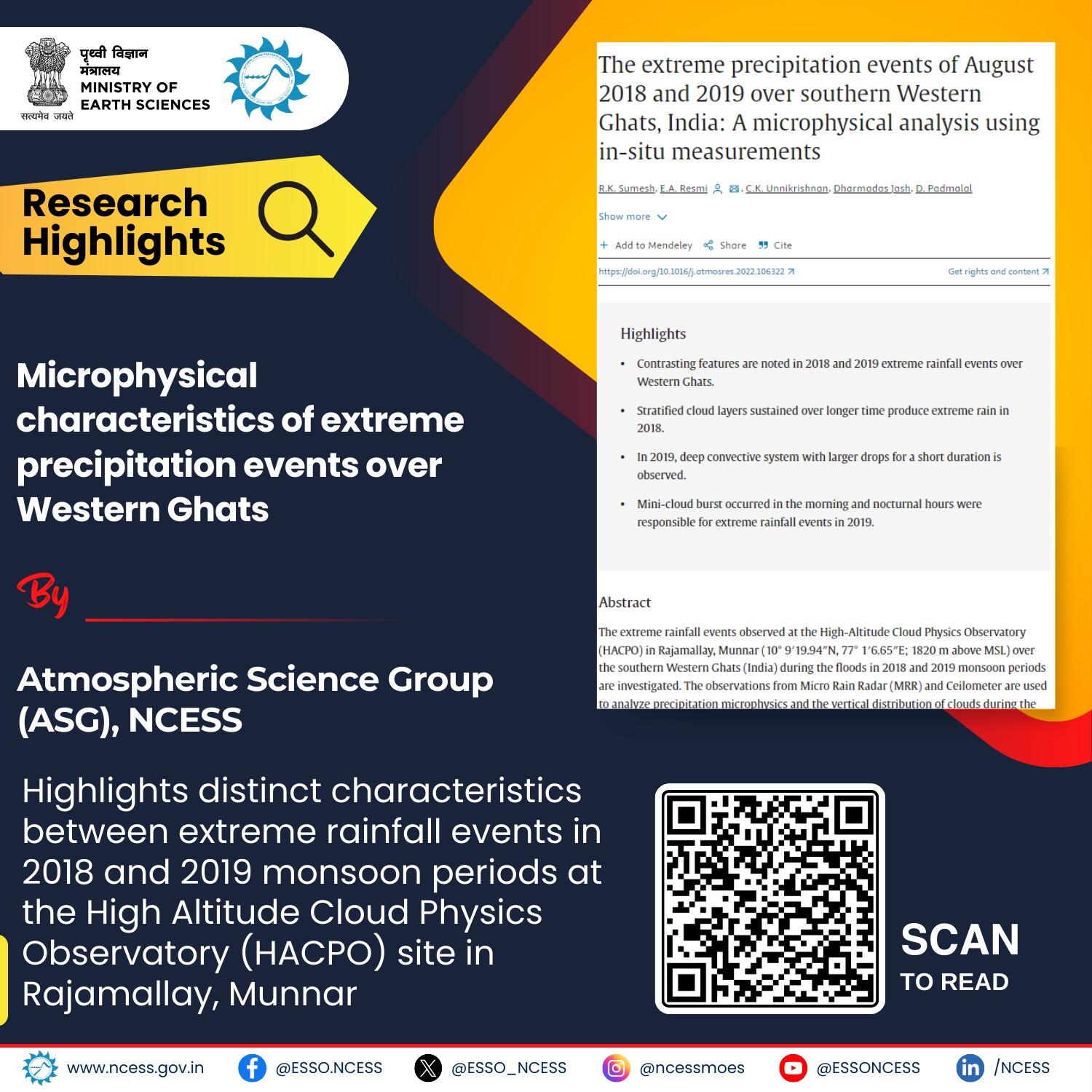
This Research Study indicates a mixed-phase microphysical process during the intense rainfall hours on 8th August 2019, contributing to convective rainfall from deep cloud bands with enhanced rainwater content. These events highlight the potential for flash flooding in the region, emphasizing the role of environmental factors in extreme precipitation events.
Bibliographic Info: R.K. Sumesh, E.A. Resmi, C.K. Unnikrishnan, Dharmadas Jash, D. Padmalal. (2024).
https://doi.org/10.1016/j.atmosres.2022.106322.
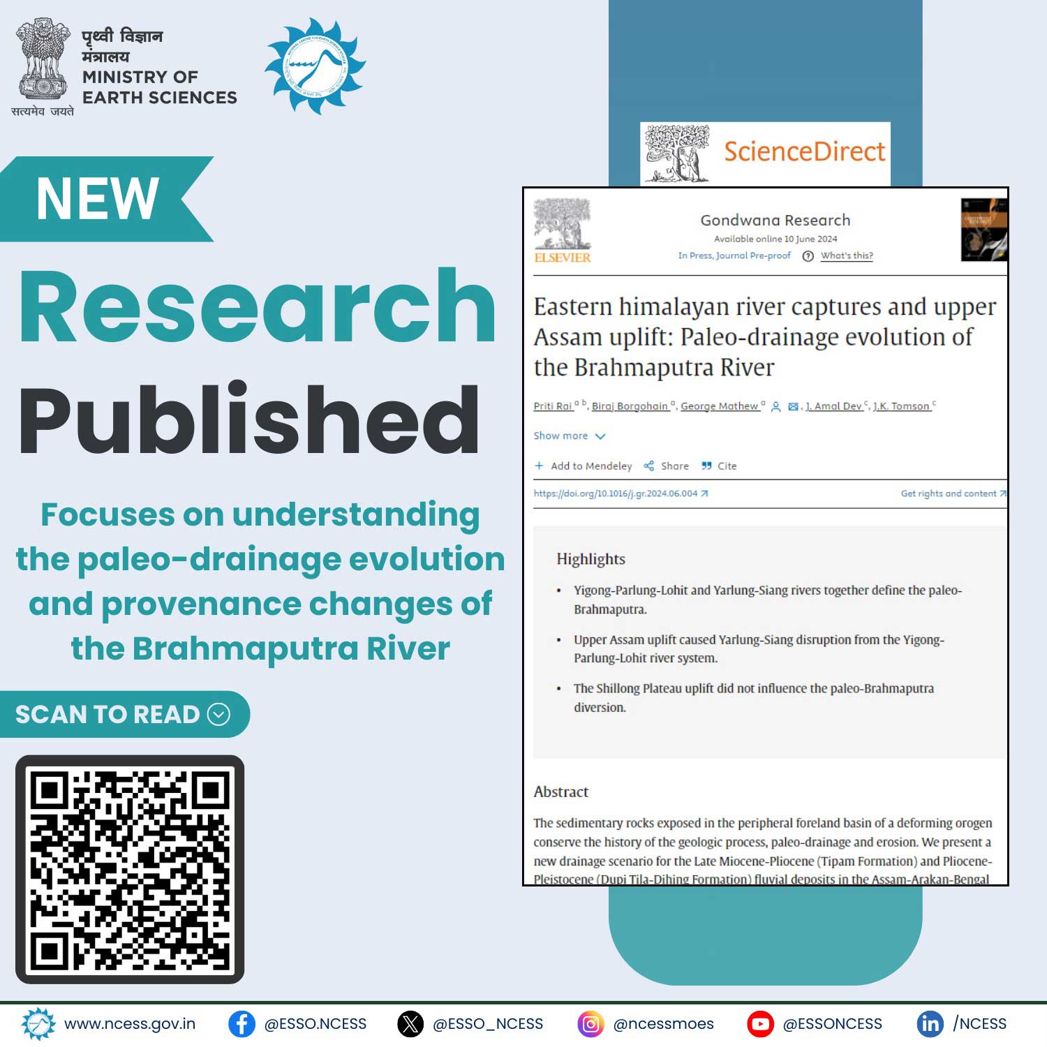
A new research collaboration by NCESS Kerala and IIT Bombay delves into the sedimentary rocks of the Assam-Arakan-Bengal Basin, revealing the dynamic evolution of the Brahmaputra River's paleo-drainage system and its complex relationship with geological processes.
Bibliographic Info: Priti Rai , Biraj Borgohain , George Mathew , J. Amal Dev , J.K. Tomson. (2024).
https://doi.org/10.1016/j.gr.2024.06.004.
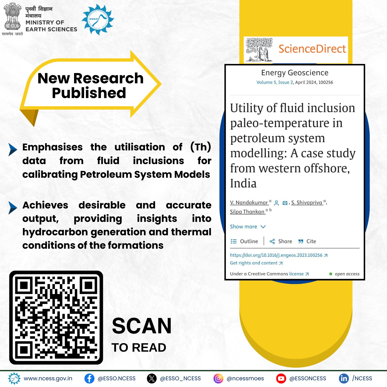
A new research by NCESS Kerala unveils hidden hydrocarbon shows in "dry" wells and the added advantage of using Th in Petroleum system modelling over traditionally used parameters in defining generation and expulsion.
Bibliographic Info: V. Nandakumar, S. Shivapriya, Silpa Thankan. (2024).
https://doi.org/10.1016/j.engeos.2023.100256.
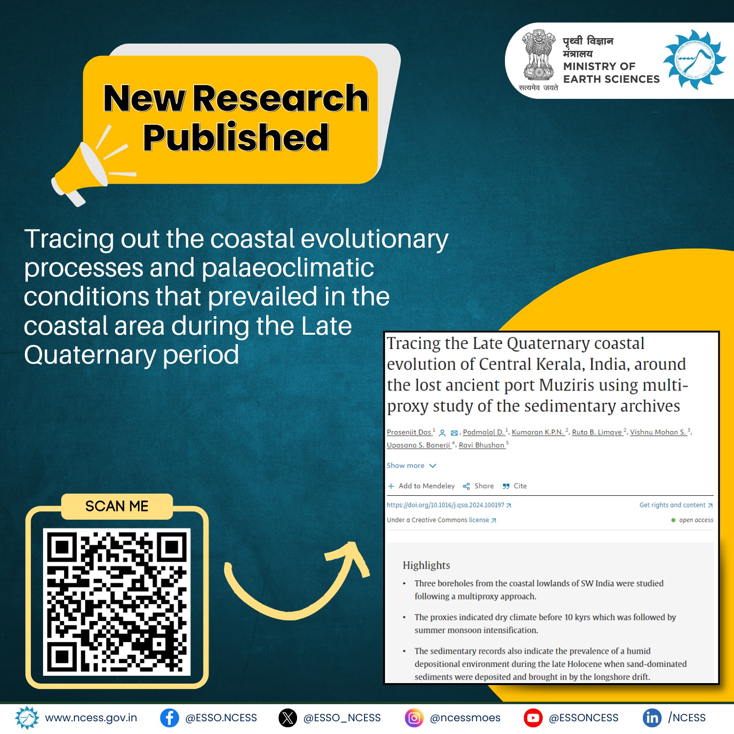
A new research by NCESS unveils coastal evolution & paleoclimatic conditions of the Late Quaternary period through three drilled cores. This study offers invaluable insights into the historical processes that have shaped our coastal landscapes over the years.
Bibliographic Info: Prasenjit Das, D. Padmalal, K.P.N. Kumaran, Ruta B. Limaye, S. Vishnu Mohan, Upasana S. Banerji, Ravi Bhushan. (2024).
https://doi.org/10.1016/j.qsa.2024.100197.
Accurate estimation of Moho topography plays a crucial role in understanding Earth’s structure, geodynamic processes, and resource exploration. This study presents a novel approach that utilizes conditional Generative Adversarial Networks (cGAN) to reveal Moho topography based on observed gravity anomalies. Synthetic training datasets of Moho topography were generated using the FFT filtering method due to the scarcity of true datasets. Spherical prism-based forward gravity modeling was employed to evaluate the resulting gravity anomalies.
Bibliographic Info: Arka Roy, Rajat Kumar Sharma, Dharmadas Jash, B. Padma Rao, J. Amal Dev,J.K. Tomson. (2024).
https://doi.org/10.1016/j.jseaes.2024.106093.
News and Events
Research Updates
- Tracing the Late Quaternary coastal evolution of Central Kerala, India
- Imaging of moho topography with conditional generative adversarial network from observed gravity anomalies
- U-Pb geochronology of rutiles from Southern granulite Terrane, India
- Metamorphic and tectonic evolution of the Southern Granulite Terrane, India
- Origin of TTGs and high-K granitoids in the Bundelkhand Craton, Central India
- Detrital zircons in crustal evolution: A perspective from the Indian subcontinent
- Age of Kaladgi Supergroup, India
